Death of a Mall: Sarnia's Bayside
 Looking out from Sarnia Bay towards downtown and Chemical Valley, on July 29, 2021.
The indoor shopping mall located in the heart of downtown Sarnia, Ontario opened in early 80s as Sarnia Eaton Centre, and was later renamed to Bayside Mall after the demise of Canadian department store chain, Eaton's, and then to Bayside Centre before its demolition in 2021. It is a common story throughout Canada and the USA: big box retailers kill department stores, and the malls once anchored by these department stores die along with them. The death of these malls often results in conversions to even more pedestrian-unfriendly power centres (aka. "demalled").
The story of Bayside Centre is unusual because it is also part of the story of a downtown, representing the resilience of traditional main street retail and independent, local business rather than the triumph of big box retail chains (perhaps the presence of the much larger Lambton Mall on the outskirts of the city didn't help either). And instead of being converted into yet another horrible power centre and reinforcing car culture, the demolition of Bayside Centre is opportunity for urbanization, intensification, and promoting walkability of a historic city centre.
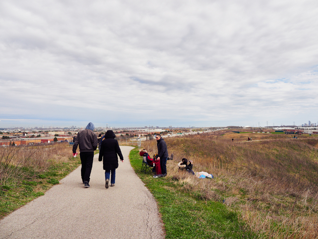
 Weekend Walkabout on Christina Street in Downtown Sarnia on July 24, 2021.
Sarnia's downtown might not be as big or as well built up as one might expect for that of a city of over 70,000 people. Not enough of the vibrancy of a city, and not enough of the charm of a small town, it is situated in an awkward position. It does feel like a place that is stuck in time, perhaps held back by the presence of the mall. It probably doesn't help that the downtown and the mall are not actually located bayside. Sarnia Bay, the part of the waterfront where the locals gather, actually lies further upstream to the north. To the east, the mall noticeably disrupts the downtown street grid, with Lochiel Street broken up into two parts. Where Lochiel Street once ran became the main front and rear entrance to the mall, adjoining the Eaton's store. Fittingly, this was the first part of the mall that was demolished.
Weekend Walkabout on Christina Street in Downtown Sarnia on July 24, 2021.
Sarnia's downtown might not be as big or as well built up as one might expect for that of a city of over 70,000 people. Not enough of the vibrancy of a city, and not enough of the charm of a small town, it is situated in an awkward position. It does feel like a place that is stuck in time, perhaps held back by the presence of the mall. It probably doesn't help that the downtown and the mall are not actually located bayside. Sarnia Bay, the part of the waterfront where the locals gather, actually lies further upstream to the north. To the east, the mall noticeably disrupts the downtown street grid, with Lochiel Street broken up into two parts. Where Lochiel Street once ran became the main front and rear entrance to the mall, adjoining the Eaton's store. Fittingly, this was the first part of the mall that was demolished.
 The demolished rear entrance of mall, on July 22, 2021.
 The former Eaton's location, on July 23, 2021.
Not all of the mall will be demolished, however. The former Eaton's store (pictured above) facing the west side of Christina Street, the main street of Sarnia, was in the process of being converted into a standalone building. It was being renovated and subdivided into multiple retail units, which had yet to be filled at the time I was there.
The former Eaton's location, on July 23, 2021.
Not all of the mall will be demolished, however. The former Eaton's store (pictured above) facing the west side of Christina Street, the main street of Sarnia, was in the process of being converted into a standalone building. It was being renovated and subdivided into multiple retail units, which had yet to be filled at the time I was there.
What exactly is to become for the rest of the mall property? I asked this question to one of the locals and they told me that a retirement home is be built, which surprised me. Searching online I can confirm that the land is owned by an Oakville-based company, Seasons Retirement Communities, but their plans have stalled. When I returned to the city the following year, I did see some small government office buildings had been built on the north side of the site directly behind the former Eaton's. Hopefully, the rest of the site gets redeveloped soon to bring more people into downtown Sarnia and support its small businesses.
 Seaway Lane separates the mall and the historic structures on the west side of Christina Street.
On July 29th, I arrived at the main entrance to the mall to find that Lochiel Street had been closed off with red ribbon at Christina Street, so I assumed demolition was going to happen sometime that day. Not knowing the exact time, I wandered around town for a bit, and unfortunately I arrived a little late and missed the beginning of the demolition. And I didn't stay for as long as I wanted to either because as the mall crumbled it filled the air with dust. All over my clothes, my camera, my lens. In panic, I actually retracted the extended barrel of my lens when it was still covered in dust, which only made me even more panicked.
Seaway Lane separates the mall and the historic structures on the west side of Christina Street.
On July 29th, I arrived at the main entrance to the mall to find that Lochiel Street had been closed off with red ribbon at Christina Street, so I assumed demolition was going to happen sometime that day. Not knowing the exact time, I wandered around town for a bit, and unfortunately I arrived a little late and missed the beginning of the demolition. And I didn't stay for as long as I wanted to either because as the mall crumbled it filled the air with dust. All over my clothes, my camera, my lens. In panic, I actually retracted the extended barrel of my lens when it was still covered in dust, which only made me even more panicked.
Luckily, both my Olympus E-M1 Mark II and 12-100mm f/4 IS PRO are dustproof. The main reason I bought this combination in late 2019 was for a trip to Vietnam, which got cancelled due to the COVID-19 pandemic a few months later. I didn't think I would need the weather-sealing and dust-sealing in Sarnia. It was very fortunate because this dust would have destroyed my previous camera and/or made me miss capturing this potentially defining moment in Sarnia's history.
 Access to Lochiel Street and the front entrance of the mall closed at 4:51PM EDT on July 29, 2021.
 Demolition at 6:35PM EDT.


If you are interested in seeing the rest of the photos in this series, please visit Sarnia: Bayside (2021) in my gallery.
At Home He's a Tourist: The U.S. Invasion of Canada
At home he feels like a tourist
He fills his head with culture
He gives himself an ulcer
- Gang of Four, "At Home He's a Tourist"
Much has been said about U.S. president Trump's open threats to annex Canada, calling it the "51st state", mockingly referring to the prime minister as "Governor Trudeau", applying pressure to Canada with tariffs, but something that has been less talked about is how much of Canada that the U.S. has already taken over. From our businesses, our products, our politics, how much of what we do and consume is dominated or influenced by the U.S.
 At Home He's a Tourist 9Yonge-Dundas Square
There is no better example of the pervasive U.S. influence than Yonge Street in Toronto. This is the main street of Canada's largest city, the country's most famous and iconic street, so surely not only should it represent what Toronto is all about, it should also reinforce the Canadian identity. Someone walking down Yonge Street should get a taste of Toronto's culture, and by extension a taste of Canada's culture. Yonge Street should be a place that is special and unique to Toronto, showing people and reminding people, whether they are Canadian or not Canadian, what being a Torontonian and what being Canadian really means. And yet...
 At Home He's a Tourist 7Outside the Eaton Centre
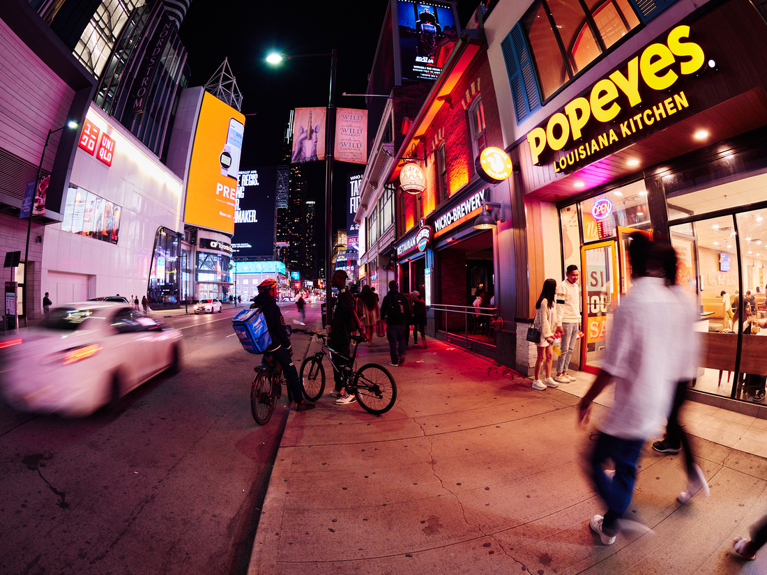
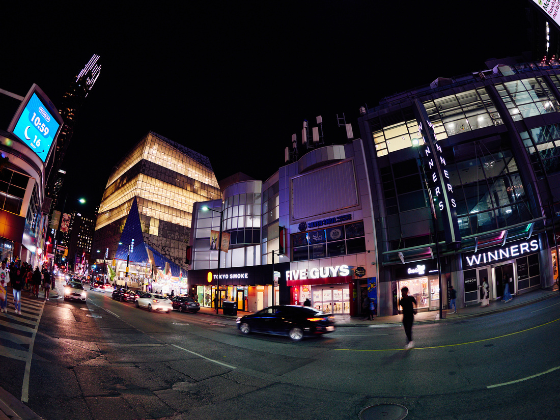
While this all may have been true in the past, you will find very little of what makes Toronto "Toronto" or Canada "Canada" remaining along Yonge Street in the downtown core. Many of those locally-owned, mom-and-pop shops have long been replaced multi-national retail and restaurant chains. The U.S. brands especially dominate the streetscape today. The American tourist visiting Toronto may as well have just stayed home. After all, they don't get a taste of Toronto or Canada by eating at another Popeyes. And the European tourist may as well have just gone to the U.S. instead to get a true taste of U.S. culture (assuming they are not concerned about being arrested, imprisoned, and deported by US border control).
 At Home He's a Tourist 14Yonge north of Dundas
Of course, the real dilemma here is for Canadians, especially Torontonians. If even Yonge Street of all places has become "Americanized", robbed of all its identity, then what about the rest of the city? What about the rest of Canada? Where can we experience the true Toronto? What does it really mean to be Canadian nowadays? In response to Trump's tariffs, there has been a growing "Buy Canadian" movement, but it could be more difficult to follow than most Canadians realize.
But perhaps it will serve as a wake-up call and reminder of how important it is to support local, independent businesses. And when I say local and independent, I don't just mean Canadian. Because this is not really about Canada. In this particular example, it's really about Toronto. And this should be also be a wake-up call to people outside of Canada. Wherever you live, whether it be in Canada, the U.S.A., the U.K., France, Germany, etc., don't just think about your country, think about your city.
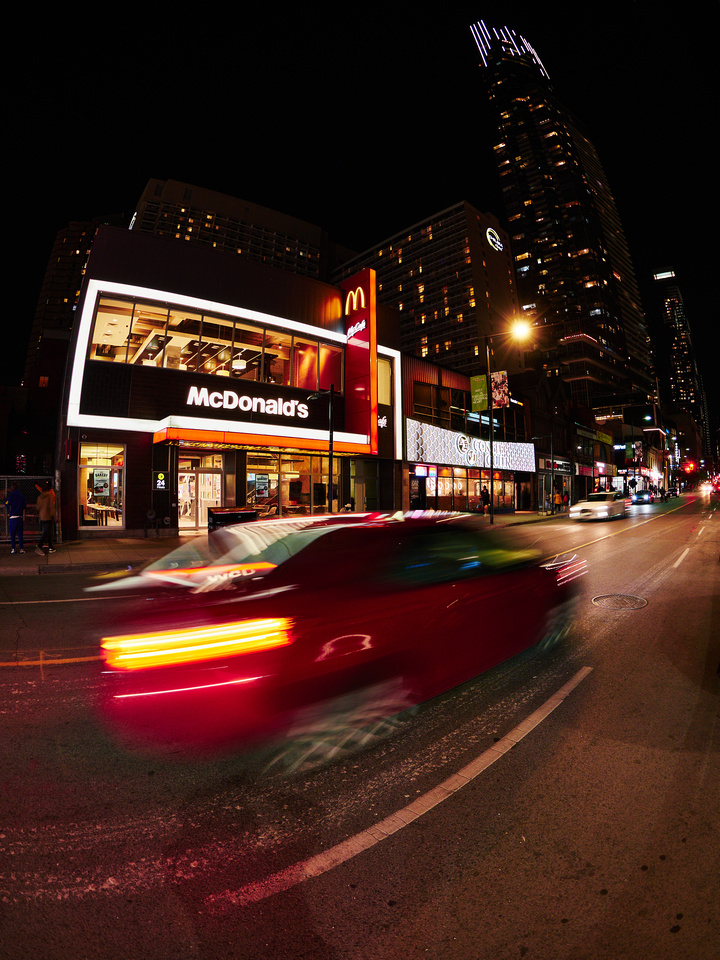 At Home He's a Tourist 16McDonald's at 356 Yonge St.
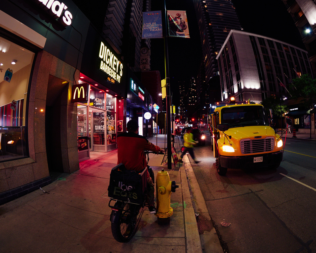 At Home He's a Tourist 21McDonald's at 470 Yonge St.
 At Home He's a Tourist 25McDonald's at 552 Yonge St.
Madill Farm: Mississauga's Vanishing Past and Uncertain Future
Mississauga, Ontario, west of Toronto, is known in Canada for urban sprawl, its name almost synonymous with sprawl, and longtime mayor, Hazel McCallion, sometimes referred to as the "Queen of Sprawl". With Mississauga growing so outward so rapidly, building new subdivisions and paving over Canada's highest grade farmland with little hesitation, these developments were sometimes separated by farms.
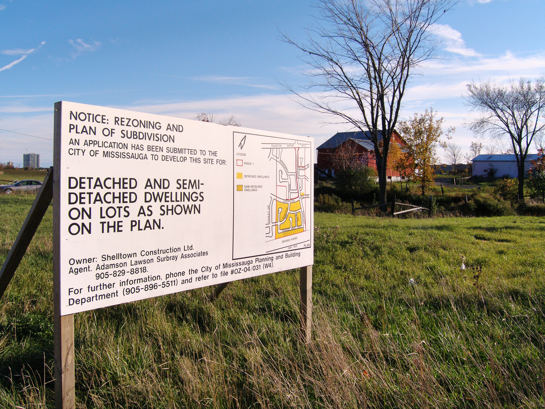
One such farm lay on the south side of Eglinton Avenue at McLaughlin Road, belonging to Earl Madill (1912–2001). His younger brother, Ben Madill (1915–2013), also owned a farm down the road at McLaughlin Road and Highway 401, which lasted until 2006 before being burned down and eventually replaced by an industrial park. Although Earl Madill died twelve years earlier, his farm lasted longer, until 2008. Even passing by it almost every day, its appearance was always striking, not just because of the vibrant red paint of the barn house and silos, but also for being a kind of oasis in the midst of urban sprawl. I couldn't help but visit it with my new camera and capture it in what could be its final moments.
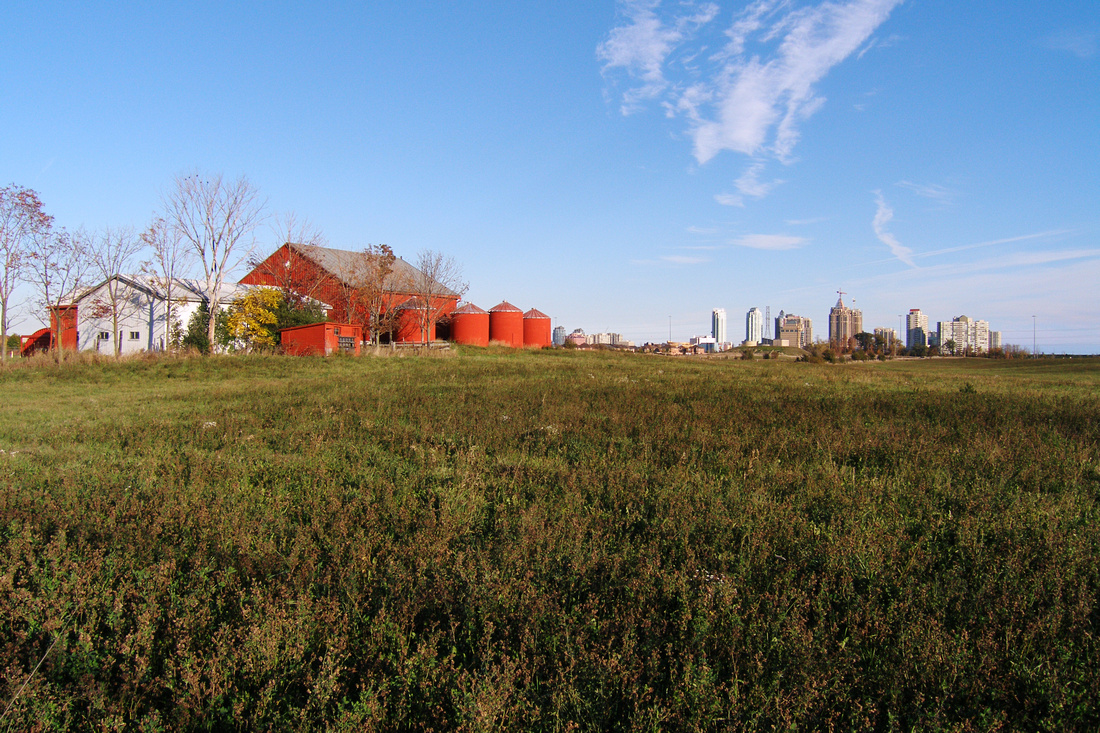
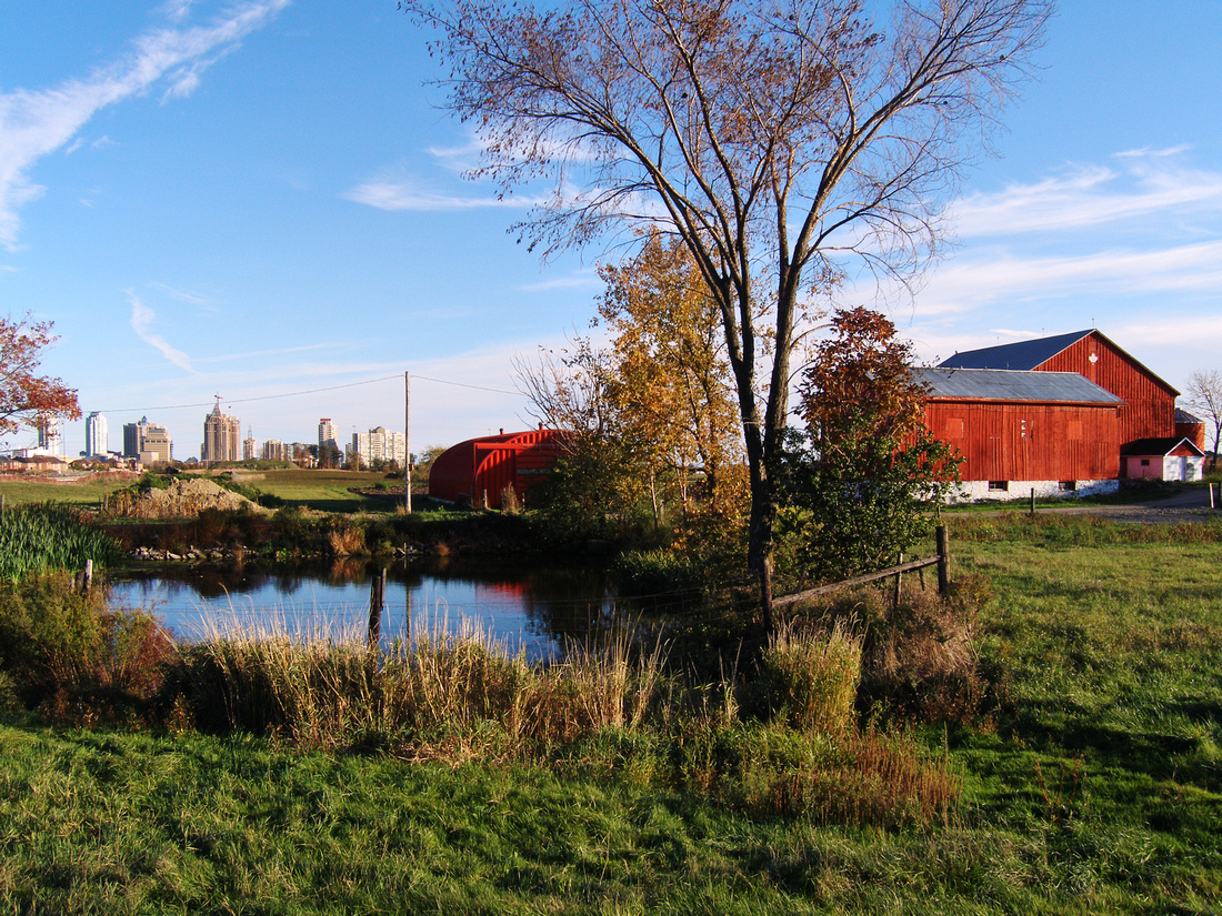
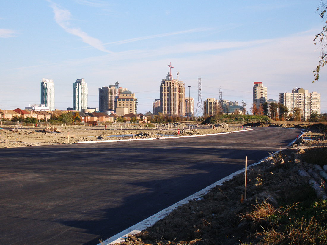
Another reason the farm was always striking was because the high-rise condominium and office towers always in the background. The land lay directly at the boundary of Mississauga's City Centre district, the city's burgeoning "downtown". If you had gone to the Square One Shopping Centre back then, there was a good chance you would have passed by this farm. Perhaps the sight of skyscrapers next to farmland shows some restraint and foresight on part of the City of Mississauga. However, Eglinton Avenue was originally designated by the City as a "Major Transit Corridor", alongside Hurontario Street and Dundas Street, and the city did not quite fulfill Eglinton's potential in that regard. Even in the midst of a condo boom, when the city extended Confederation Parkway through the property from what the city envisioned to be its future downtown, there was no high-density development built, only the typical detached and semi-detached houses.
As mayor, Hazel McCallion was extremely popular with voters for not raising taxes, developing a reputation for efficient spending. In truth, these property tax freezes (effectively tax cuts, if inflation is taken into account) were made possible due to the massive revenue from development fees as the result of Mississauga's extreme rapid growth. As Mississauga became built-out, and the development slowed, so too did the revenue from development charges, forcing the City of Mississauga to start increasing property taxes.
Perhaps Mississauga's growth was inefficient other ways, and there has been a greater cost that the city is paying for today. Younger generations looking to buy their first home are paying the price too, as Mississauga's population declined by 0.5 percent from 2016 to 2021, even in the face of a major housing shortage. The concern for this and other long-term consequences of sprawl, and the increasing recognition to build cities for the future, was the impetus for the establishment of the Toronto-area greenbelt with the Places to Grow Act in 2006. But for the younger generation looking to buy their first home in Mississauga, the Places to Grow Act came too late.
In the Westside Eclipse Part 2, or: Why a Default White Balance of "5500K" Doesn't Work
White balance is a difficult aspect of post-processing photos, something I am still struggling with and learning about to this day. This problem was especially acute when I tried to edit the photos I took of the solar eclipse just west of Toronto in April. It was an exceptional situation, not quite day, not quite night, something I had never experienced before, and likely will never experience again, so I had no reference point. That's why it bothers me when certain "influencers" try to portray white balance as something very simple, such as a default of "5500K".
First of all, it is important to discuss what exactly is colour. In terms of light (additive colour), you have red, green, and blue as the three primaries. In printing and painting (subtractive colour), you have cyan, magenta, and yellow as the three primaries. These six primaries together form the colour wheel, where red is opposite to cyan, green is opposite to magenta, and blue is opposite to yellow. Red is in-between magenta and yellow, so it is combination of both in the subtractive colour model, or a component of both in the additive colour model.
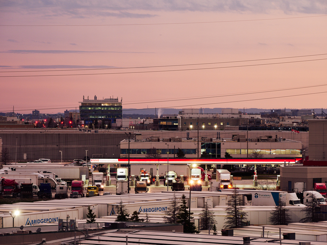
Secondly, it is important to think about what exactly "5500K" means in-camera or in a raw-editing software. This is actually more specifically a colour temperature, which defines the white balance in terms of red vs. blue. Changing the colour temperature of a photo has little to no effect on the green channel. To adjust the amount of green, we must set the tint, which defines the white balance in terms of green vs. magenta. As magenta is a combination of blue and red, changing the tint will also affect the amount of blue and red in a photo. So colour temperature is but one component of white balance, along with the tint. The importance of tint became obvious to me when I was editing this particular photograph:
Here is what this photograph would have looked like if I had simply set the OM-D E-M1 Mark II to a "Custom WB" of 5400K and left the "G" (Green) parameter at the default of 0:
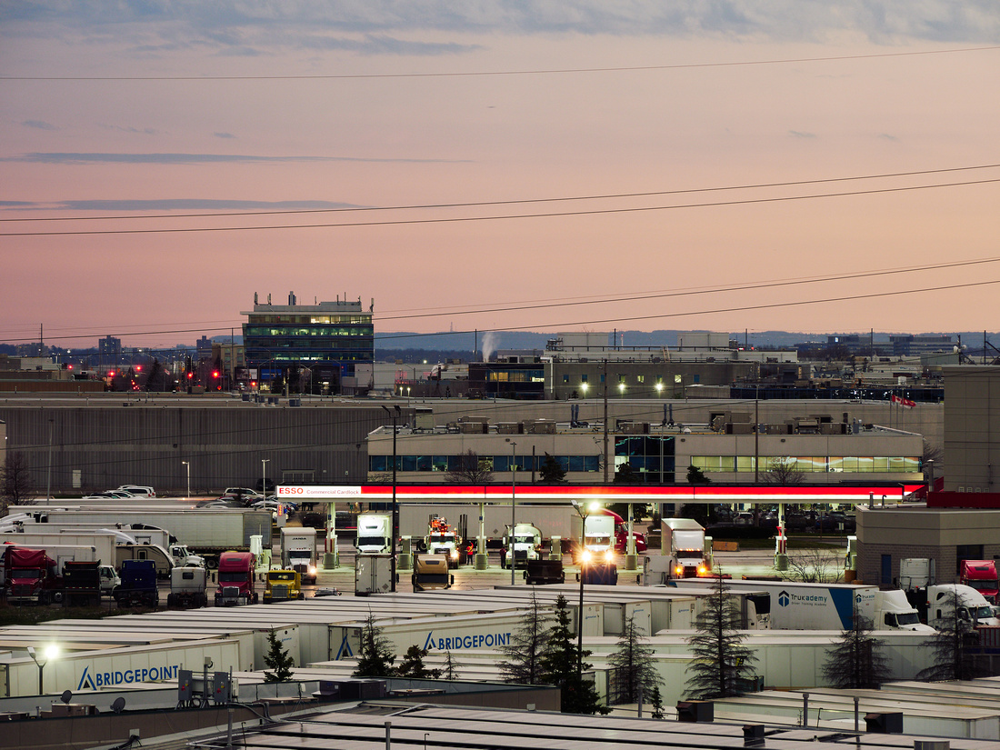
If you look closely, you might be able to spot a major problem: the lights of the gas station are green! This can be confirmed by hovering the mouse cursor over the pixels in question and looking the RGB values in Capture One; the G values are higher than the R and B values. There is some greenness on the shipping containers in the foreground as well. This greenness can only be corrected by using the Tint slider. This will shift the white balance away from green towards magenta, which in turn will increase the reds, which in turn must be compensated for with a reduction in colour temperature. In-camera with my OM-D E-M1 Mark II, this means setting "Custom WB" to 4600K and "G" to -6 to make what I see in the viewfinder match what I see with my naked eye.
So do our eyes really see everything at 5500K by default? Not mine at least. In fact, the way my eyes see constantly changes. When I am in bed at night and I suddenly turn on the lights, or I am in bright room at night and I suddenly turn off the lights, it takes some time for my eyes to adjust. Of course, mentally, as a photographer, I am often making a concerted effort to look at things in a different way. But even just physically, my eyes are constantly adjusting, and therefore my camera should also be constantly adjusting along with them.
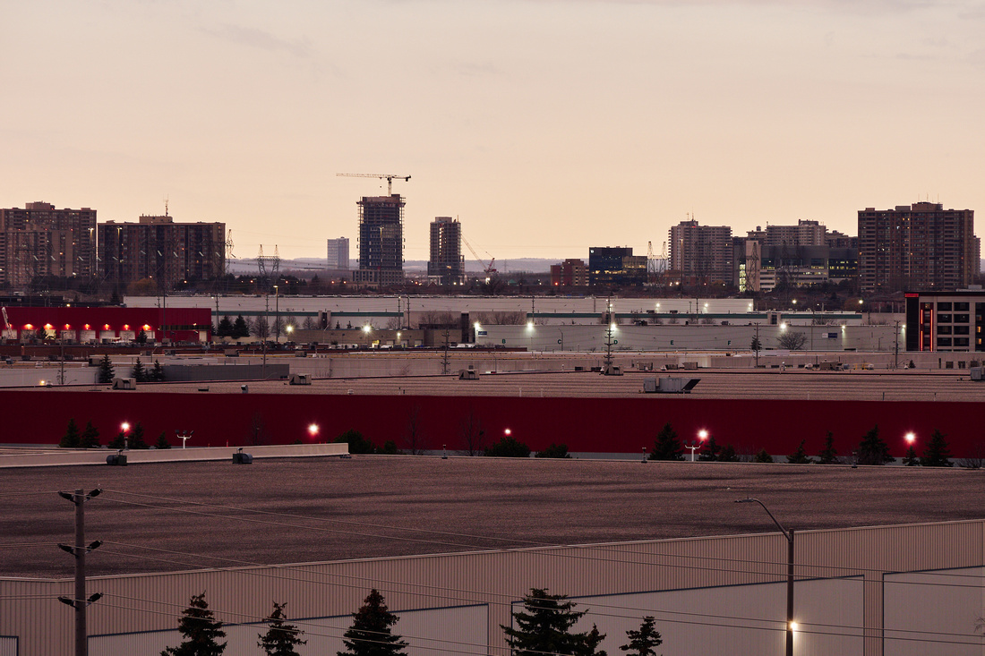
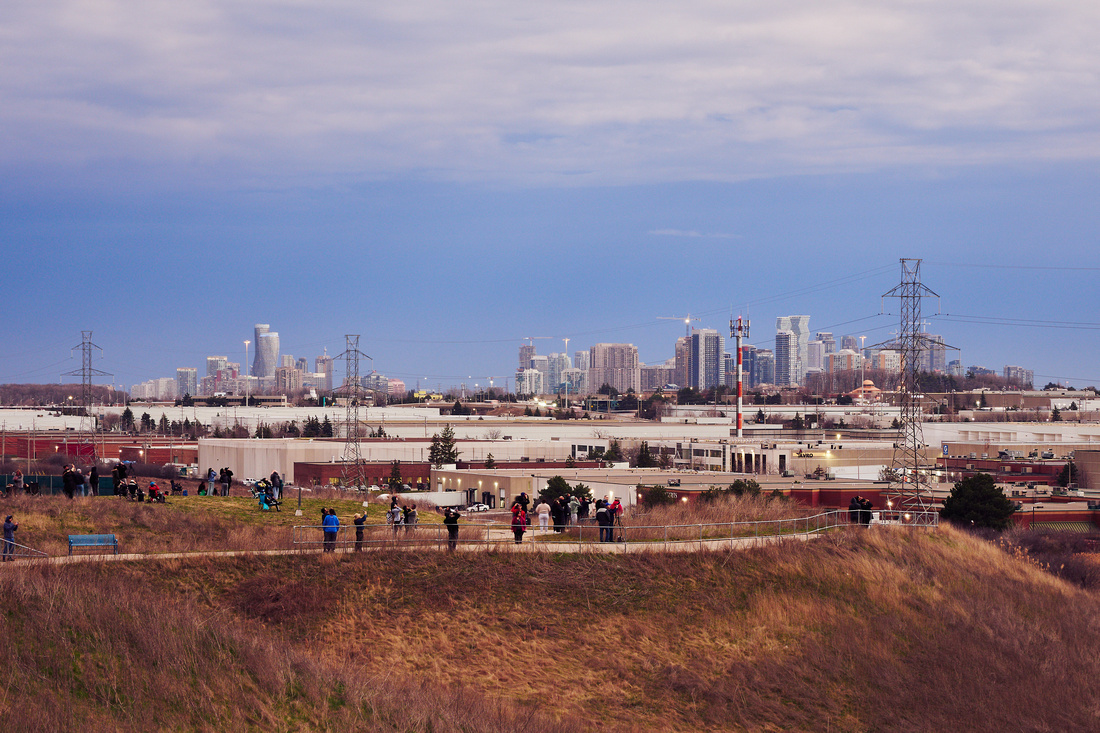
In the Westside Eclipse: Afternoon Turns to Dusk in the Greater Toronto Area
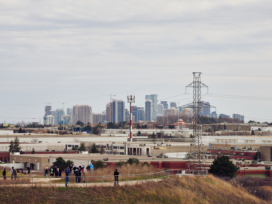
Even leaving home before 2:00 PM (EDT), which was said to be the beginning of the eclipse, I thought was I already too late, but to my relief the sky still remained bright. Arriving at Danville Park 15 minutes later and seeing the amount of cars in parking lot and people walking about the tall hill there, I thought again that I was too late, but to my relief there was still space. Being located in an industrial area in the north part of Mississauga, immediately west of Toronto, the park and the hill is still kind of a hidden secret.
They said that the full eclipse would occur at 3:19 PM so I had plenty of time to set up my Olympus E-M1 II and 12-100mm f/4 on the the tripod. But even from that point on, I could see the shutter speed of my camera gradually declining, from 1/400 sec. to 1/3 sec. The darkness lasted until 3:22 PM during which the clouds immediately surrounding the sun did part a little bit to the delight of everyone. Of course, I was more concerned about the landscape, as I usually am.
People lament the cloud cover, but they made for some dramatic skies, and almost made me feel like real landscape photographer. Being 70km northwest of the Path of Totality, the brightness of the sky was uneven as I looked southwest, the left side becoming very dark, the right side remaining bright, which only further added to the drama.
 2:52:51 PM
 3:09:01 PM
 3:19:42 PM
 3:20:09 PM
 3:21:00 PM
 3:21:50 PM
 3:26:43 PM
3:29:02 PM